Ground conditions and utilities
Water Eaton is being designed with careful consideration of the on-site flood risk and utilities.
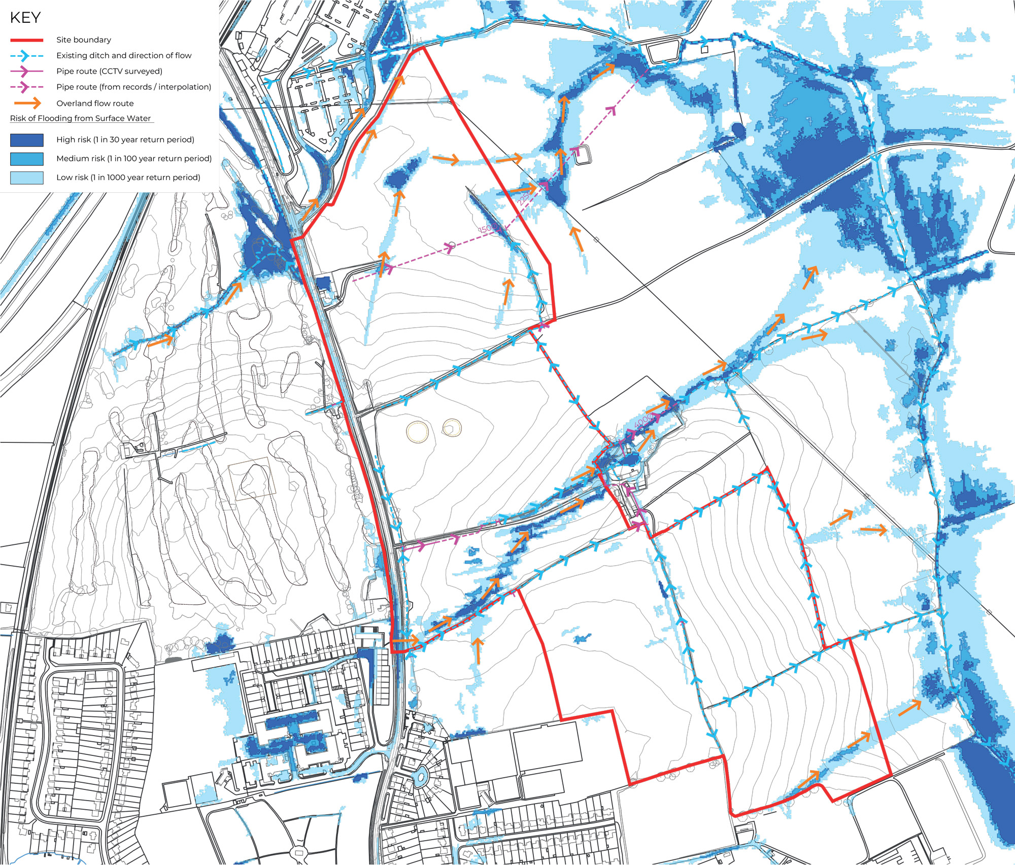
Flood Risk
The site is located in Flood Zone 1, land with the lowest risk of flooding from rivers.
The majority of the site is at very low risk of surface water flooding. The masterplan will consider and preserve overland flow paths and existing drainage routes where appropriate. This is to ensure there is no flood risk to the development and no increase in flood risk off-site.
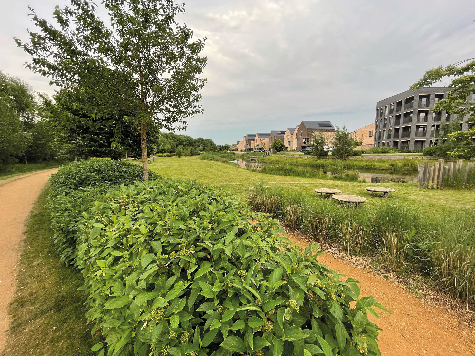
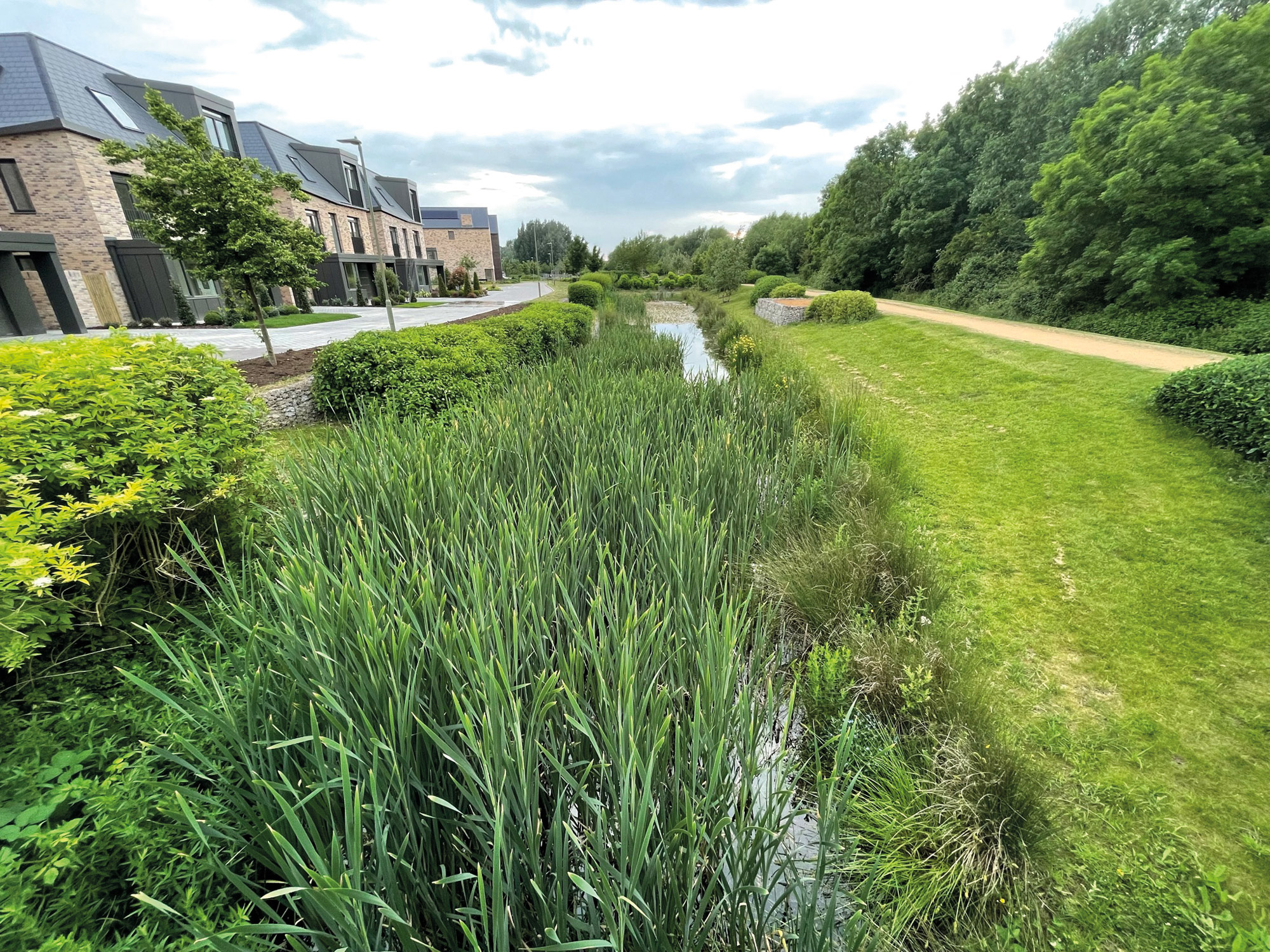
Surface water drainage
The surface water drainage strategy will mimic the existing on-site drainage, discharging run-off into the network of watercourses at rates matching pre-development.
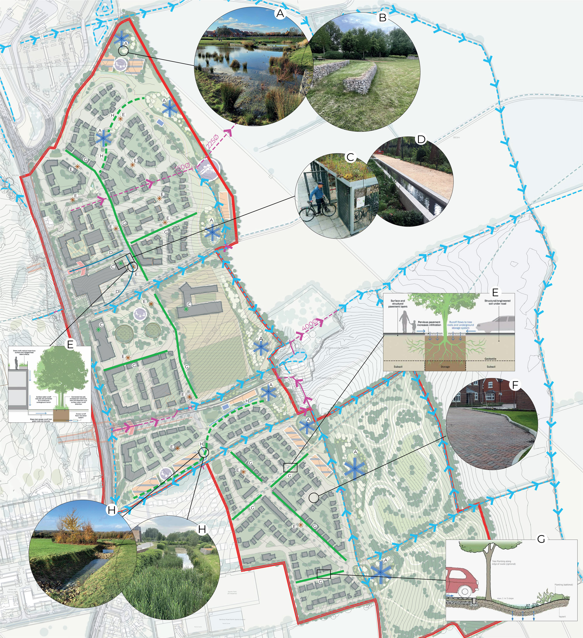
Sustainable Drainage Systems
Sustainable Drainage Systems (SuDS) such as ponds, basins and swales will be designed in varying shapes, sizes and depth in order to work within the constraints of the site and to allow for the future effects of climate change.
Click image to enlarge Pinch to zoom
Foul drainage
Thames Water has been consulted and has confirmed that reinforcement works to the foul drainage network will be required to serve Water Eaton. Liaison is ongoing with Thames Water to ensure that the development is included in their modelling at the appropriate stage, in order to ensure that the required capacity is provided when it is needed.
Utilities
Thames Water and SSE have been consulted about potable water supply and electricity supply and have confirmed that reinforcement works to the water and electricity networks will be required. Liaison is ongoing with Thames Water and SSE to ensure that the required capacity is provided when needed.
Click image to enlarge Pinch to zoom
Click image to enlarge Pinch to zoom
Our proposals sections
- Introduction
- Our proposals
- The development
- The scheme parameters
- Masterplan
- Character and placemaking
- Responsible ownership & stewardship
- A sustainable development
- Transport
- Sustainable transport improvements
- Green infrastructure
- Site heritage
- Ground conditions and utilities
- Ecology and biodiversity
- Landscape and visual
Plan showing risk of flooding from surface water
Click image to enlarge Pinch image to enlarge
Flood zone map

Click image to enlarge Pinch image to enlarge